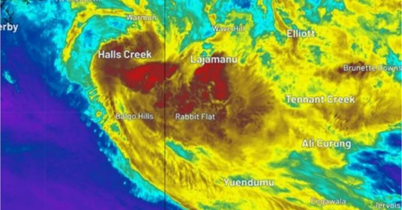
The ex-tropical cyclone dumped hundreds of millimetres of rainfall over the weekend in the Northern Territory.
dumped hundreds of millimetres of rainfall over the weekend in the Northern Territory, triggering flood watch warnings in the Gregory and Tanami districts.
The low is expected to move into the waters off the Kimberley coast from today, where it's expected to intensify, the Bureau of Meteorology warned.There's a chance Ex-Tropical Cyclone Lincoln could redevelop. "We will see the wind speed really start to ratchet up around the ex-tropical cyclone through the course of the second half of the week," Meteorologist Angus Hines said.
"Thursday and Friday bring a high risk - 60 per cent chance of re-intensification back into a tropical cyclone for what would become, once again, Tropical Cyclone Lincoln. "It is offshore Friday morning but after that, it's going to move a little back towards WA, hooking back around to the south and eventually the south-east."The low is expected to move into the waters off the Kimberley coast from today. The Bureau has also issued several flood watch warnings for parts of the Northern Territory, including Central Inland Rivers, Bonaparte Coastal Rivers and Kimberley.
Australia Latest News, Australia Headlines
Similar News:You can also read news stories similar to this one that we have collected from other news sources.
 Tropical Low Expected to Form into Cyclone Kirrily off North Queensland CoastA tropical low intensifying off the coast of North Queensland will form into Cyclone Kirrily on Thursday, with residents warned to act now to prepare.
Read more »
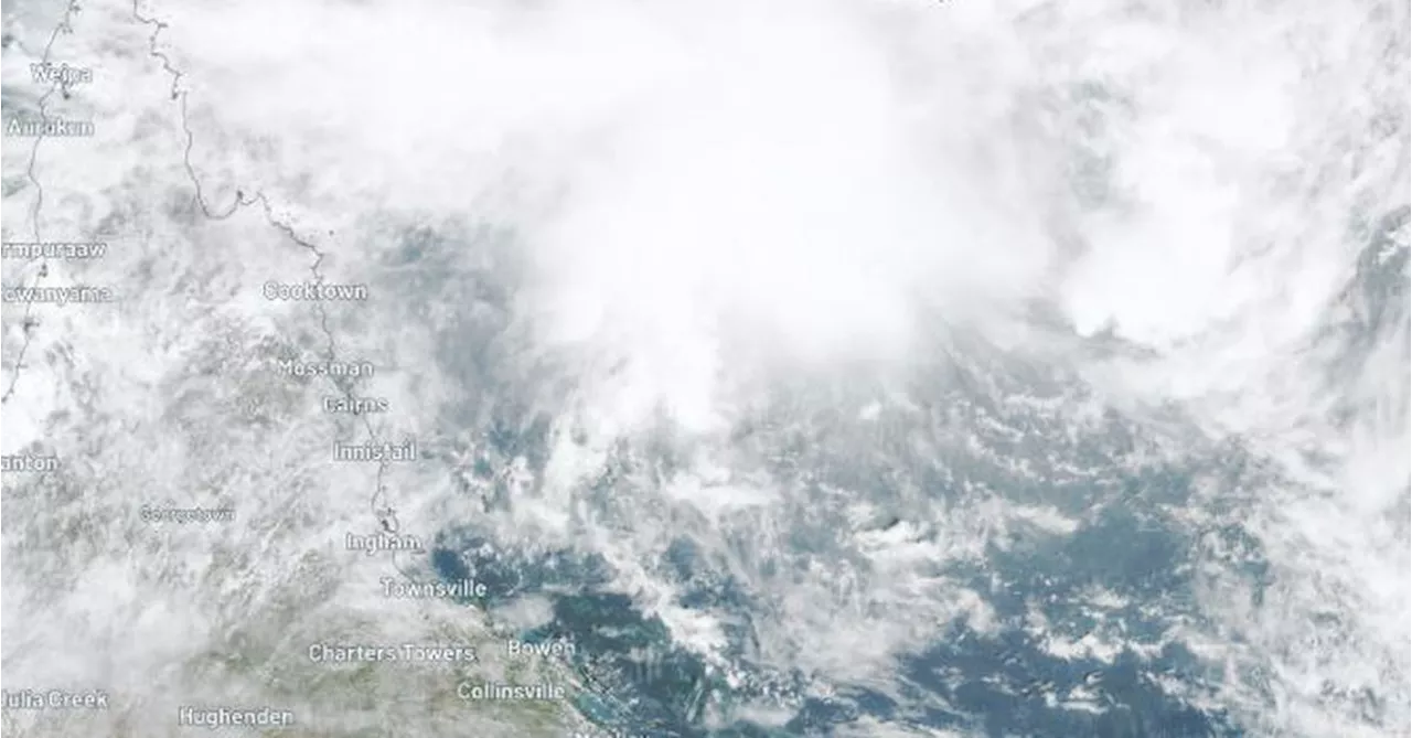
 Tropical Low in Coral Sea Expected to Become CycloneThe tropical low developing slowly in the Coral Sea is now expected to become a cyclone later on Wednesday, as the system tracks south-west towards the Queensland coast. The system, travelling at just 7 kilometres per hour, will most likely cross on Thursday night as a category two cyclone, with wind gusts of up to 150kph, according to the Bureau of Meteorology (BOM). It is expected to make landfall between Cardwell and Bowen, and will start impacting the coast and islands by Wednesday night. Several coastal communities are now in the warning zone from Ayr to Mackay, including the Whitsundays.
Read more »
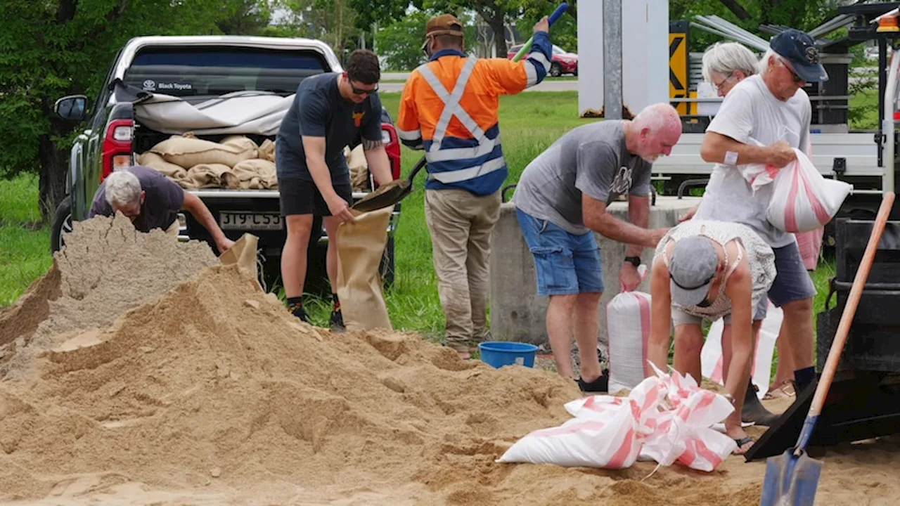
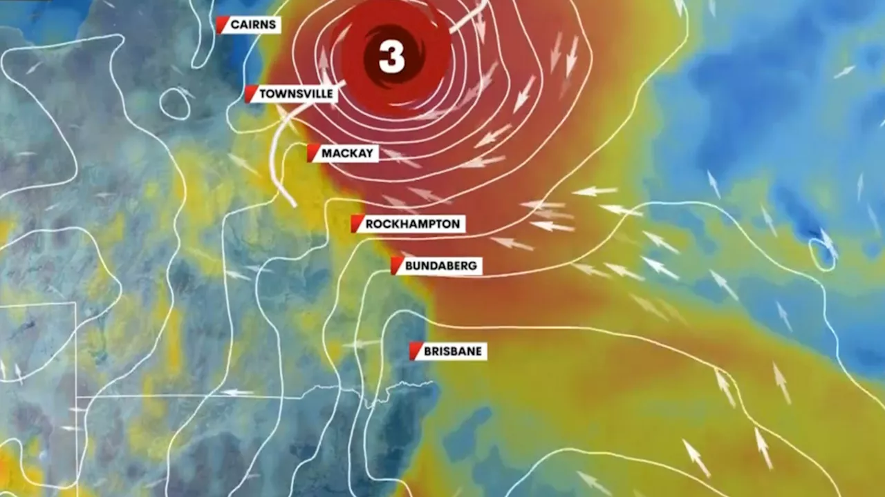 Queenslanders brace for category three cyclone as Kirrily threat loomsQueenslanders are preparing for a category three cyclone named Kirrily, which is expected to cross the coast later this week. Meteorologist Tony Auden provides three likely scenarios for the cyclone's impact on Queensland.
Read more »
 Cyclone Kirrily leaves thousands without power in North QueenslandTens of thousands of homes are without power across Townsville and surrounding areas after Cyclone Kirrily pummelled North Queensland with 'very destructive' wind gusts of up to 170km/h. The focus early this morning was gradually shifting to 'life-threatening' flash flooding after the storm was downgraded to category 1 about midnight (1am AEDT).
Read more »
 Cyclone Kirrily Upgraded to Category 3 StrengthCyclone Kirrily is expected to cross the Queensland coast near Townsville tonight. Meanwhile, concerns are raised about the conditions in Queensland's temporary holding places for kids.
Read more »