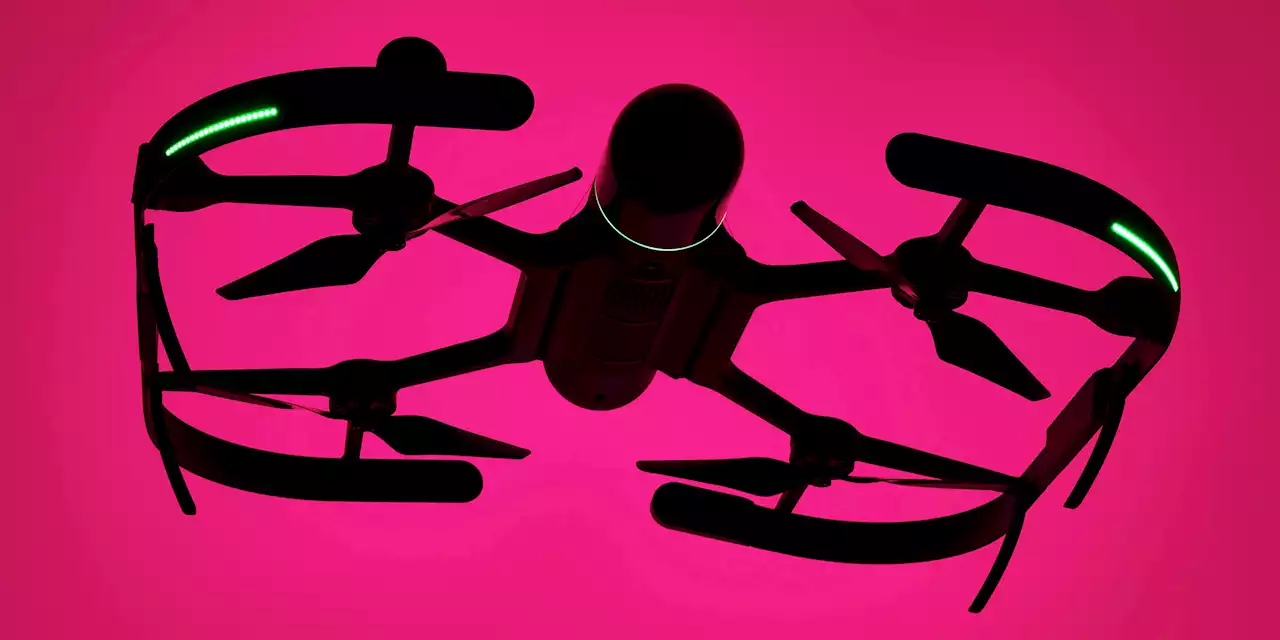
Leica Geosystems BLK2FLY, an autonomous flying laser scanner, can capture detailed dimensions of structures, buildings, and other hard-to-reach (or dangerous) areas
his autonomous flying laser scanner can capture detailed dimensions of structures, buildings, and other hard-to-reach areas. It’s not a drone, because you don’t have to pilot it. Instead, the device uses radar sensors, cameras, and GPS—all packed into a compact carbon and glass fiber frame—to create what Leica Geosystems calls “,” while navigating around any obstacles such as trees and wires.
, which went on sale in April, has been used to monitor structural safety across 160 acres of Italy’s Archaeological Park of Pompeii.
Australia Latest News, Australia Headlines
Similar News:You can also read news stories similar to this one that we have collected from other news sources.
 Ehrman Crest Elementary/Middle School: The 200 Best Inventions of 2022Ehrman Crest Elementary/Middle School near Pittsburgh aims to show how physical spaces can impact educational outcomes. Find out why the K-6 school is on TIME's list of Best Inventions of 2022:
Read more »
 JordiLight: The 200 Best Inventions of 2022Think of JordiLight as the Swiss Army Knife of lights. Find out why the utility torch made TIME's list of Best Inventions of 2022:
Read more »
 The best baby travel systems for 2022Whether you’re off for a walk in the woods or popping into town, the best travel system makes getting around with a baby easy.
Read more »
 The 70 Best Beauty Advent Calendars Of 2022 To Have On Your RadarCalling all beauty fanatics, discover the best beauty advent calendars 2022 has to offer with Vogue’s ultimate guide.
Read more »