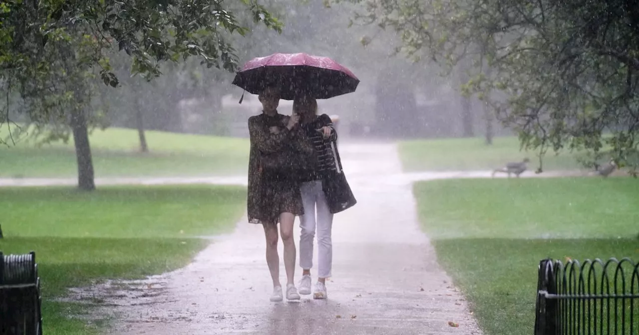
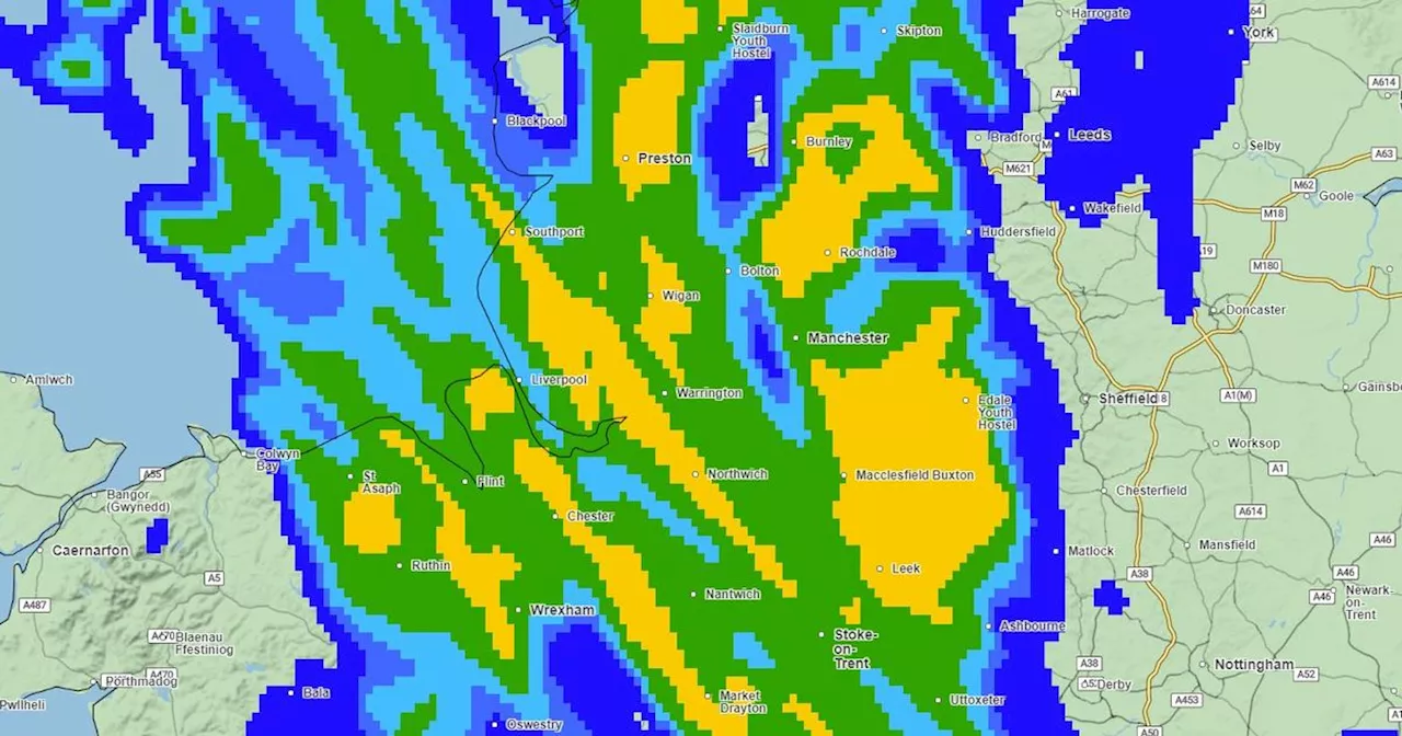
Parts of the North West have been warned of more unsettled conditions today
It comes shortly after a similar warning was issued for parts of the South of England and Wales yesterday. Now, a warning has been extended to some major cities across the North West, the South, and the Midlands from 12pm today until 11.59pm tonight.
Some major areas covered by the warning include Stoke-on-Trent, Peterborough, Birmingham, and Oxford. Due to the predicted adverse weather conditions, commuters are warned of potential travel disruptions, including possible delays or even cancellations to certain train and bus services.There's also a likelihood of power outages in areas covered by the thunderstorm warning, which could impact both residential and commercial properties.
Thunderstorms and heavy rains hit parts of the capital and surrounding areas over the previous night. In it's forecast for tonight, the Met Office said: "A cloudy start in places, especially over the Pennines, however many will have a sunny day with cloud lifting and breaking. "There is the possibility of a few heavy showers in the south this afternoon. Feeling warm in the sunshine. Maximum temperature 20 °C." It added: "A mostly dry night but turning increasingly cloudy, with many areas becoming misty and murky by dawn.
Australia Latest News, Australia Headlines
Similar News:You can also read news stories similar to this one that we have collected from other news sources.
 Met Office predicts 'driest and sunniest' weather for North West next weekIt follows a wet and windy weekend
Read more »
 Greater Manchester's weather as Met Office and flood warnings hit North WestPeople are being urged to take care
Read more »
 Met Office weather warning issued for North WestSome travel disruption is expected at the weekend as 50mph gusts hit the west of England
Read more »
 Met Office predicts 'North-South divide' with warm weather only for half of UKThe North is expected to come out on top
Read more »
 Storm Kathleen to Bring Strong Winds and Hottest Day of the Year for UKStorm Kathleen is expected to bring both strong winds and the hottest day of the year so far for the UK, as warm air from the continent hits the country this weekend. The Met Office has stated that temperatures could reach up to 22C in East Anglia, while western areas will see gusts of up to 70mph on Saturday. The weather experts also issued a yellow weather warning for wind in the north west and south west of England, parts of Northern Ireland, Scotland and Wales, from 8am to 10pm on Saturday. Met Office meteorologist Ellie Glaisyer said: "The storm is the reason we are seeing the warmer temperatures, because the location of the storm - situated out towards the west of the UK - is bringing a southerly wind across the UK. "This is bringing those warmer temperatures from the continent, meaning we are likely to see temperatures reaching 22C." "The highest temperature of the year to date was 19.9C, recorded at the end of January at Achfary in north-west Scotland
Read more »
 Met Office weather experts issue warning to all UK gardenersThe Met Office has told gardeners to 'be aware'
Read more »