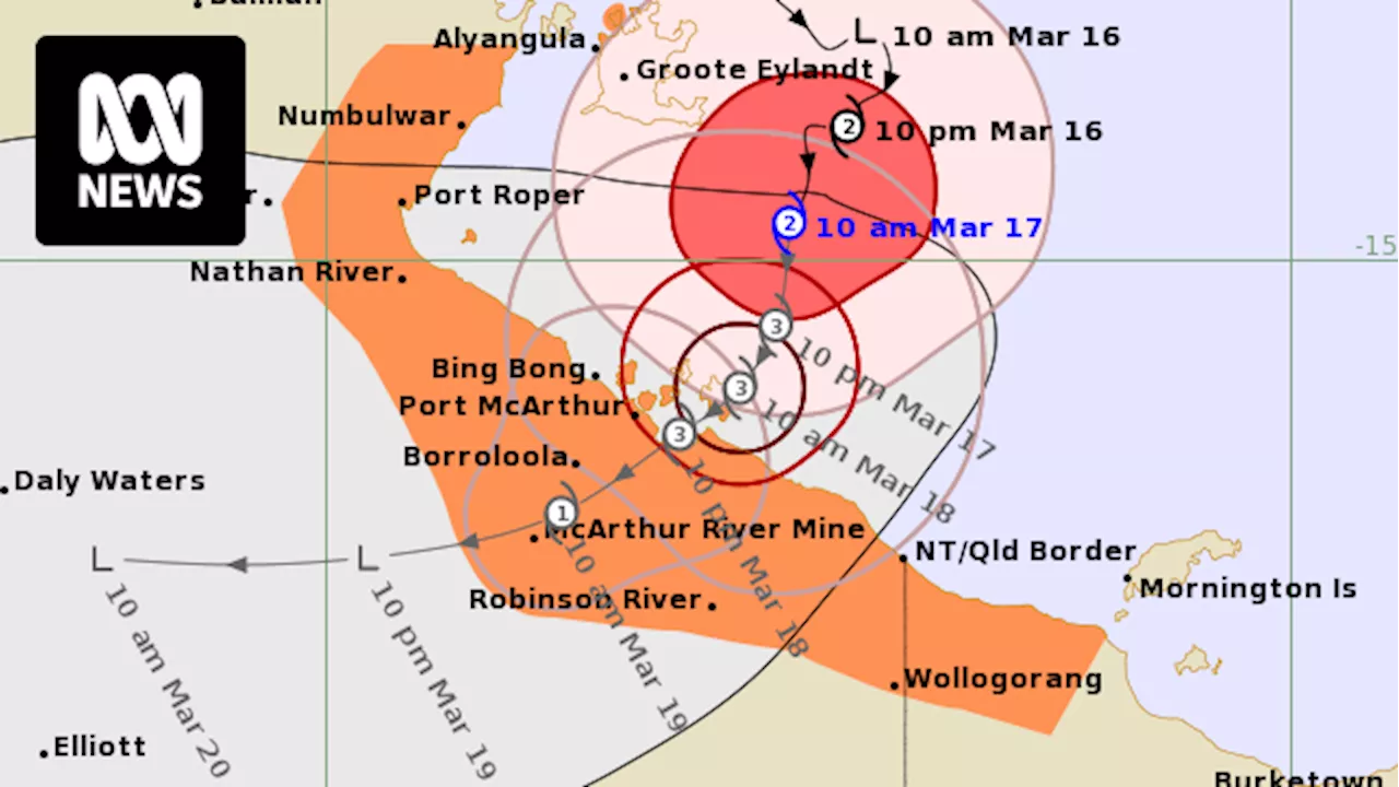
Tropical Cyclone Megan is due to make landfall in the Northern Territory on Monday.
Residents in the Northern Territory and Queensland have been warned to plan for an emergency ahead of"severe" Tropical Cyclone Megan making landfall on Monday evening.The cyclone has been upgraded to category 3, with sustained winds near the centre of the storm reaching 130 kilometres an hour.
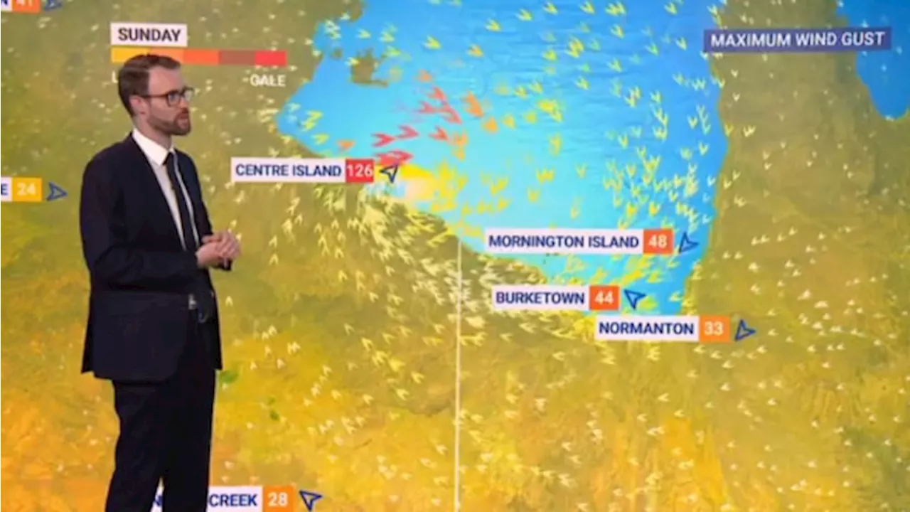
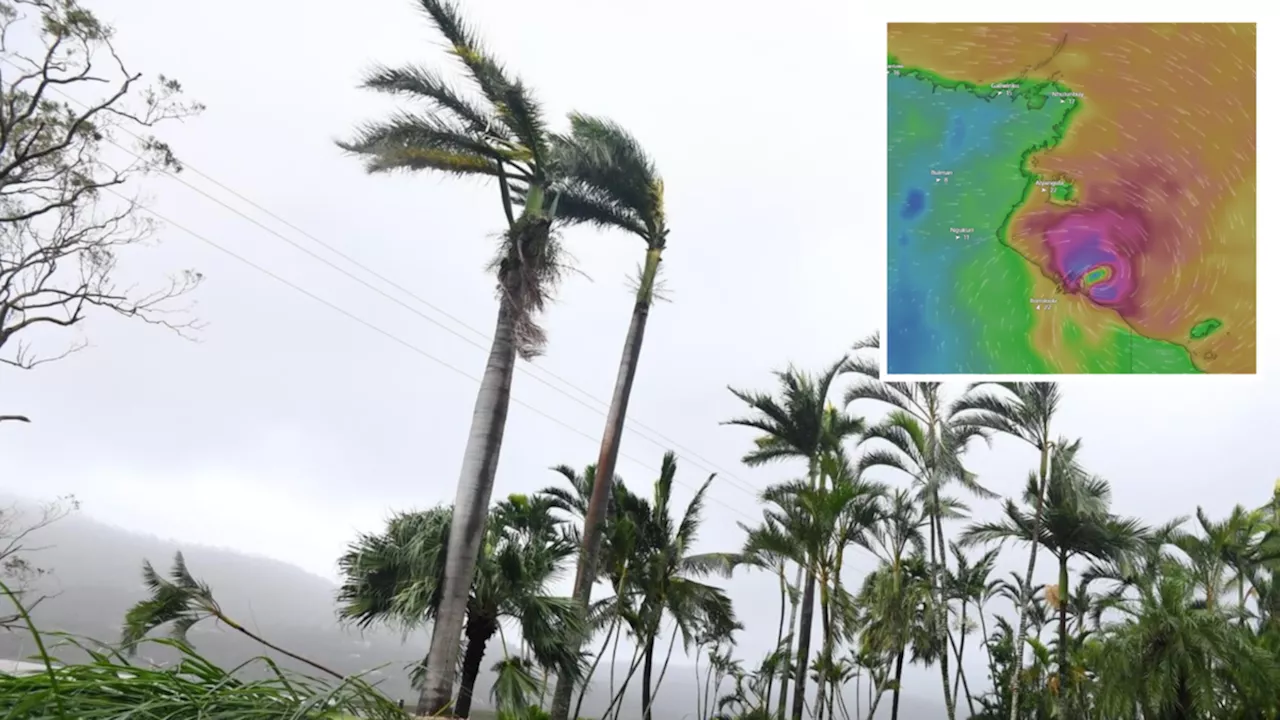
The Bureau of Meteorology issued an alert at 3.30am on Monday morning, warning coastal residents of “damaging waves” and “dangerous flooding”, and “intense rainfall” for Monday with the likelihood to continue into Tuesday. Sky News Meteorologist Rob Sharpe said the storm had already breached land with the eye of the storm sweeping over the Pellew Group of islands, lashing Centre Island with more than 200mm of rain.
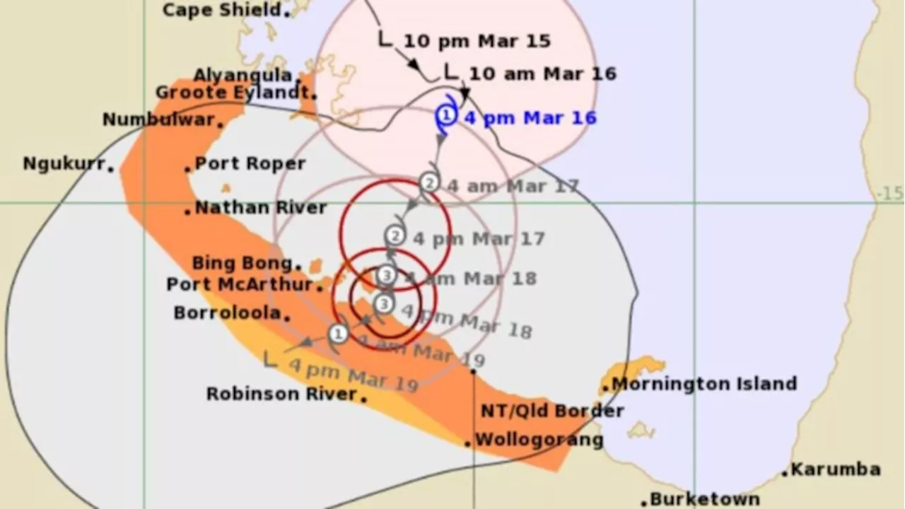
The Northern Territory Emergency Service advise communities to “enact your household emergency plan now” and to “check on your neighbours”. People residing in areas between the border and Mornington Island are told to remain inside until the cyclone has passed. Picture: WeatherZone
Australia Latest News, Australia Headlines
Similar News:You can also read news stories similar to this one that we have collected from other news sources.
 Residents warned of ‘severe’ Cyclone Megan due to make landfall in hoursTropical Cyclone Megan is due to make landfall in the Northern Territory on Monday.
Read more »
 Tropical Cyclone Megan intensifies into category 3 cyclone, bringing heavy rains to NT coastEmergency services are warning residents in Borroloola to prepare as Tropical Cyclone Megan developed into a category 3 cyclone and could potentially intensify into a category 4 as it tracks towards the NT coast.
Read more »
 Coastal residents issued warning: Cyclone Megan is comingTerritorians have been warned to prepare as Cyclone Megan forms over the eastern coast.
Read more »
 Tropical Cyclone Megan expected to intensify into category 3 system on Sunday eveningTropical Cyclone Megan is expected to intensify into a category three system on Sunday evening as the tropical low brings huge rains to Groote Eylandt and causes power outages and flooding in Arnhem Land communities.
Read more »
 Tropical Cyclone Megan rain and winds hit Northern Territory coast7NEWS brings you the latest local news from Australia and around the world. Stay up to date with all of the breaking sport, politics, entertainment, finance, weather and business headlines. Today's news, live updates & all the latest breaking stories from 7NEWS.
Read more »
 Tropical Cyclone Megan forms ahead of Northern Territory crossing as BOM reveals predicted track7NEWS brings you the latest local news from Australia and around the world. Stay up to date with all of the breaking sport, politics, entertainment, finance, weather and business headlines. Today's news, live updates & all the latest breaking stories from 7NEWS.
Read more »