This EarthDay, learn more about how satellites and other remote sensing tools are not only revolutionizing how scientists study ecosystems, they’re also poised to become powerful new tools in the fight to protect them.
Jeannine Cavender-Bares began her scientific career with her hands in the dirt. Now, she has her eyes in the sky. As a teenager she helped her biologist dad dig deep into the leaf litter of Florida oak forests to catalog the diversity of slime molds, protists best known for uniting into unsightly blobs that creep across the landscape. But it was the oaks overhead that really fascinated her and became the focus of high school science fair entries and her graduate school research.
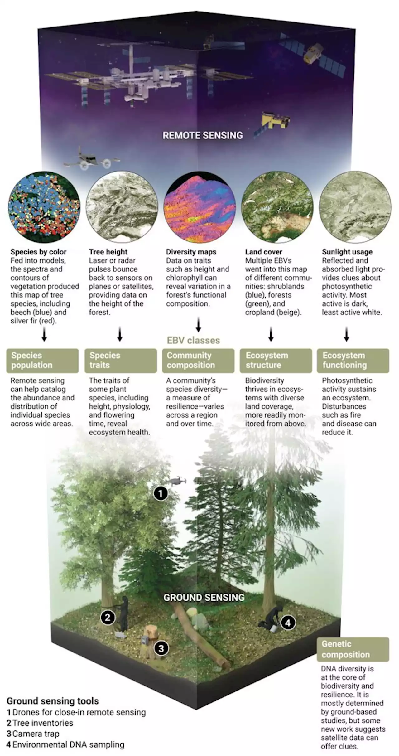
But such studies could only provide a snapshot of one forest at a time. To get the big picture of forests around the world, Cavender-Bares has sought a higher vantage. Now a plant ecologist at the University of Minnesota, Twin Cities, Cavender-Bares has devised ways to translate light measured by spectrometers flown over forests into insights about their health and resilience.
Historically, researchers had to venture out to jungles, deserts, and mountaintops to document the flora and fauna. But species distributions and abundances are changing faster than ground-based surveys can track, because of climate change, human activities, and other factors. Remote sensing offers the possibility of faster, more standardized monitoring across the entire globe.