A recent tropical low brought record-breaking rainfall to northern Queensland, causing widespread flooding. This event, while not a cyclone, highlights the growing concern about the intensifying impacts of extreme weather events. Experts discuss the unusual factors that contributed to the severity of this low and the role climate change may be playing in increasing the frequency and intensity of such events.
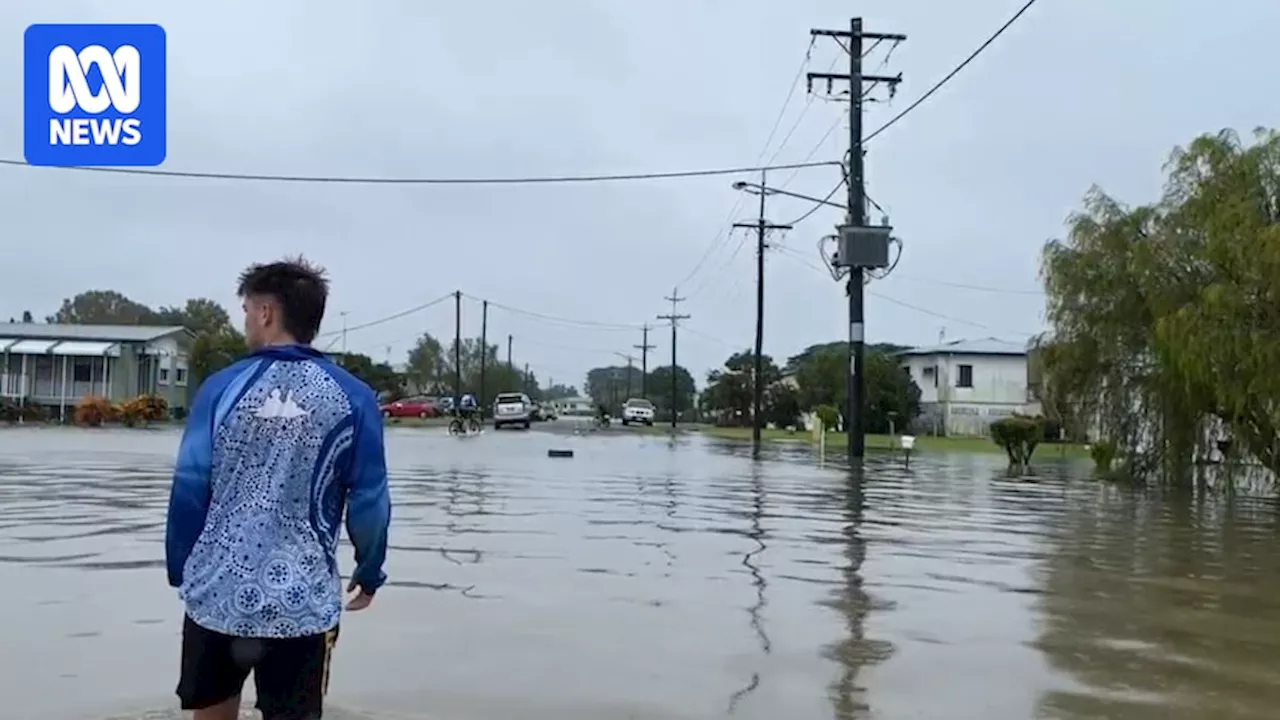
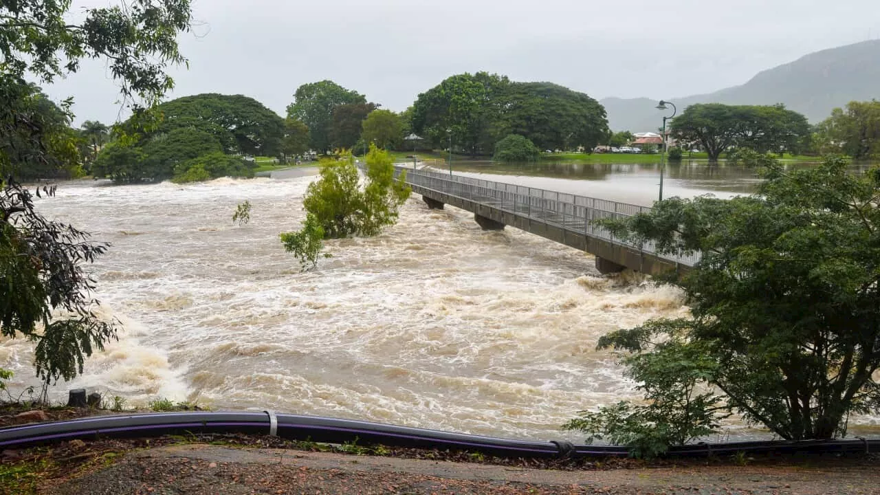
There was no destructive cyclone, yet a set of unfavourable ingredients caused a fairly common weather system to wreak havoc in northern Queensland this week. A staggering amount of rain has inundated the state's north-east coast since a tropical low formed off the coast of Cairns a week ago. Some places picked up nearly two metres of rain in a matter of days — triple the amount Melbourne gets in a year — in what has now become a record-setting event for the region.
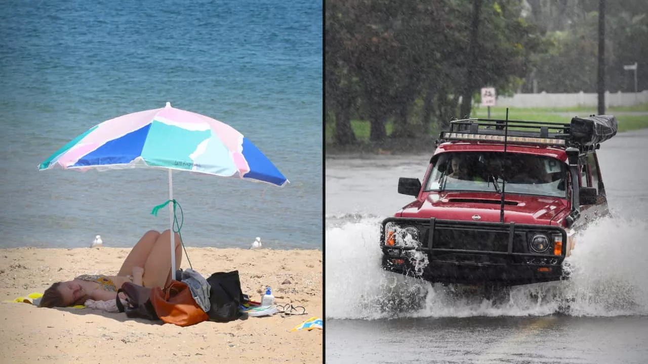
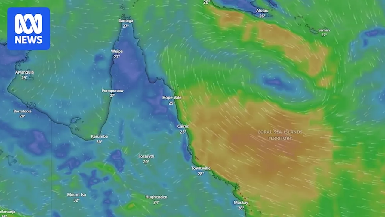
The tropical low, which can form multiple times a year in the region, joins a growing number of similar systems that delivered devastating flood impacts to wider Queensland as well as other places around the world in recent years. So what happened to make it so severe? And should we be more heightened to the risks of tropical lows?\Tropical lows are considered the early stage of a cyclone, before winds reach sufficient strength to be classified as such. They are part and parcel of life in northern Australia this time of year, often not raising much alarm among locals in comparison to their cyclonic counterpart. But Bureau of Meteorology (BOM) forecaster Jonathan How said, in this case, there were two key elements that made it more severe: it's pace, and its fuel source. After developing off the coast of Cairns on January 28, the system drifted away from the coast for a few days, before moving back towards the coast. This meant it was able to dump rain over the region day after day, culminating in enormous 10-day rainfall totals between Townsville and Cairns. 'Even though this is the wet season, and a lot of that annual rainfall does fall within the summer months, it is quite incredible to see this amount of rainfall in just a week,' he said. Not only was it slow, it was also charged up by the Coral Sea, where sea surface temperatures have been much warmer than normal. 'The more evaporation happening off the ocean, the more water vapour is being transferred to the atmosphere. And the water vapour itself does mean more clouds and more potential for rainfall,' Mr How said.\Several daily rainfall records were also set along the coast, with some places clocking more than a metre of rain in three days. Part of the reason for the warmer sea surface temperatures has been the late arrival of the monsoon. It still hasn't officially begun, making it the latest start to the monsoon since records began in 1957-58. 'Typically when you see the monsoon form across northern Australia, the increased cloud cover and also rain helps to cool the sea surface temperatures down,' he said. However, the BOM is warning more than 200 millimetres could still fall on Townsville, Ingham and surrounds over the coming days. But this kind of extreme rainfall event is far from isolated, particularly in recent years, prompting the question: does climate change play a part?\Climate change attribution studies would need to be done to give a specific answer to how much of a role it has played in making this particular event more likely, if at all. But Dr Turton, an adjunct professor at Central Queensland University, said it was well established that climate change was causing more extreme rainfall events globally. Part of this is because a warmer atmosphere can hold more water vapour. This, in turn, means there's a bigger reservoir of moisture for rain systems — like tropical lows — to tap into when they come along. 'Climate change is basically supercharging it. It's creating ideal conditions when, from time to time, these extreme rainfall events occur,' he said. Cyclones, heatwaves, fire and flooding — we’ve seen it all. In this six-part series, Tyne Logan explores what we have learned from Australia’s extreme weather events and how to better prepare for the future. 'And they're not just in the tropics, they're occurring across the planet, even in the temperate climate.' As greenhouse gases trap more energy from the sun, the oceans are absorbing more heat from the atmosphere, resulting in an increase in sea surface temperatures, and ultimately more evaporation. So, while the warm ocean temperatures currently present over the Coral Sea are 'more likely because the monsoon was late arriving', climate change 'probably' played a role too, according to Professor Turton. 'If the of the Coral Sea was near average, we would have still had an event like that, but it would not have been as extreme.' There's also the question of whether or not tropical systems are slowing down in a warmer world. Queenslanders don't have to look very far back to find other examples of stubborn tropical lows bringing devastating consequences. Only a year ago, Cairns and the Daintree region faced similar flood impacts after ex-tropical cyclone Jasper stalled over the coast. At the end of 2023, the remnants of tropical Cyclone Jasper dumped unrelenting rain over Cairns and the Daintree, breaking more than a century of flood records
Tropical Low Queensland Floods Climate Change Extreme Weather Rainfall Records
Australia Latest News, Australia Headlines
Similar News:You can also read news stories similar to this one that we have collected from other news sources.
 Queensland faces ongoing flood emergency as record rainfall delivers devastating impactThe Bureau of Meteorology warned that Tuesday could bring heavy rainfall between Cairns and Townsville with a severe weather warning in place between Cardwell and Yabulu.
Read more »
 Australia's North Queensland Braces for Devastating Flood as Tropical Lows Unleash Torrential RainAustralia's northern tip is experiencing unrelenting rainfall, leading to widespread flooding and prompting warnings of life-threatening flash floods. Tropical lows off the coast are intensifying the deluge, with some areas bracing for up to 700mm of rain over seven days. Meanwhile, a heatwave is expected to sweep across Victoria, increasing the risk of bushfires in already vulnerable regions.
Read more »
 Severe Flooding Threatens North Queensland as Tropical Lows Unleash Heavy RainsResidents in north Queensland are facing dangerous and life-threatening flooding as widespread rainfall fueled by tropical lows inundates the region. Emergency warnings have been issued for several areas, urging residents to evacuate or seek higher ground. Heavy rainfall is expected to continue, with forecasts predicting 200-400mm of additional rainfall through Sunday and Monday. The Bureau of Meteorology warns of potential flash flooding, landslides, and road closures.
Read more »
 North Queensland Flooded as Tropical Lows Bring Life-Threatening RainfallHeavy rainfall fueled by tropical lows has caused widespread flooding and dangerous conditions in North Queensland, Australia. Emergency warnings have been issued for several areas, urging residents to evacuate or seek higher ground. The rainfall totals are expected to be significant, with forecasts predicting 200 to 400 millimeters of rain daily, and isolated areas potentially receiving over 900 millimeters.
Read more »
 North Queensland Braces for Catastrophic Flooding as Tropical Lows Unleash Record RainfallWidespread and dangerous flooding is threatening north Queensland as continuous heavy rainfall caused by two tropical lows inundates the region. Emergency warnings and evacuation orders have been issued, urging residents to seek higher ground and prepare for potential life-threatening consequences. The Bureau of Meteorology predicts record rainfall totals, raising concerns about widespread property damage, landslides, and extensive road closures.
Read more »
 Possible Tropical Cyclone Threat to Queensland CoastQueensland is bracing for potential wild weather, with the possibility of several low pressure systems developing into tropical cyclones over the weekend. Coastal areas between Townsville and Cooktown could experience heavy rainfall of up to 200 millimeters, posing a risk of flooding. While heatwave conditions are easing in some parts, western regions will remain hot, with Birdsville predicted to reach 45C.
Read more »