The long-awaited monsoon season is finally arriving in northern Australia, bringing much-needed relief from scorching heat but posing further risks of flooding for already inundated parts of Queensland. The monsoon's official arrival this weekend follows its latest start on record for Darwin, with communities eagerly awaiting the shift in weather patterns.
The northern monsoon is set to finally arrive this weekend after its latest start on record for Darwin. The arrival of the monsoon could also help ease some of the intense heatwave conditions of recent weeks, including in SA, Vic and Tas. The long-awaited monsoon looks to officially kick in this weekend over northern Australia , providing relief to those who have been baking under the stifling heat of the build-up, but furthering risk to flood-drenched Queensland .
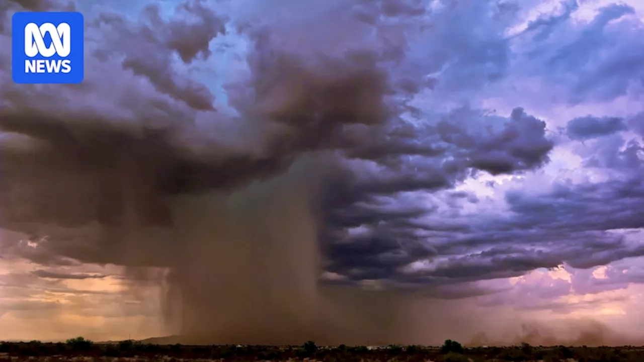
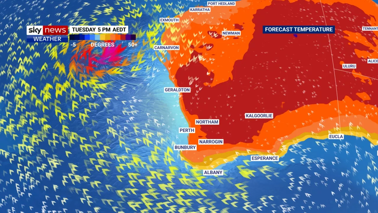
For months now, people across the Top End and parts of WA have been eagerly awaiting the seasonal shift in rains in what has become the latest onset of the monsoon since records began. The absence of cooling rains has also helped intensify heatwave conditions throughout southern states, including South Australia, Victoria, Tasmania and southern WA. But the shift is underway, with the Bureau of Meteorology expecting the monsoon to be officially declared this weekend. Heavy rain in the Pilbara in mid-January, triggered by TC Sean, was a welcome sight but many other areas have missed out. While it is a welcome reprieve for many, further rain does not bode well for flood-stricken communities in North Queensland, with more severe weather forecast this weekend. A tropical low is also forecast to develop in Western Australia over the weekend, which could bring widespread heavy rain and help bring to an end the unbearably hot temperatures, nudging 50C in some areas in the past days. The monsoon refers to a seasonal reversal of winds over northern parts of Australia, where a pattern of easterly winds switches to the west, bringing a flow of warm, humid air from Indonesia and the oceans to the north of Australia. This helps generate widespread, persistent rainfall over the region, as opposed to the isolated evening storms experienced during the build-up. BOM senior climatologist Felicity Gamble said it provided the region with the majority of its annual rainfall, as well as relief from oppressively hot and humid conditions experienced in the months prior. 'When these westerly winds do come in, it's very noticeable. You get this real shift and real relief as they bring down the temperatures and obviously bring that rainfall as well,' she said. 'Much of the north really depends on that rainfall coming in just to make sure that once we get to the dry season there's sufficient water there to last through to the next wet season.' While Darwin is the BOM's checkpoint for the monsoon, the monsoon trough can become active in other parts of northern Australia before it. This has likely been the case for Queensland this year, where the monsoon trough has already been producing heavy rainfall for the last few weeks, Unfortunately, the strengthening of the flow into the monsoon trough this weekend means already flood-ravaged parts of Queensland are facing further risk. Heavy falls between 100 and 200 millimetres are forecast from the inland town of Mount Isa to the coastal town of St Lawrence, south of Mackay. The heaviest of these are likely to hit regions already feeling the impacts of flooding, according to BOM senior forecaster Dean Narramore,'The heaviest falls in the area we're most concerned about are definitely part of the North Tropical Coast and the Herbert and Lower Burdekin, where we've already seen widespread heavy rainfall,' he said. The forecast rainfall totals are not anywhere near what the region saw last week, with some locations accumulating nearly 2 metres of rain over 10 days. But with grounds already very wet and rivers swollen, Mr Narramore warned any further rainfall would increase the risk of potentially life-threatening flooding. 'Things are already saturated and our rivers and creeks and streams are already in minor, moderate or major flooding,' he said. 'So this additional rainfall will likely lead to rapid river rises and widespread flash and riverine flooding once again.'People are being encouraged to keep up to date with the latest forecasts and warnings on the BOM's website. This time around, it's not just Queensland getting a taste of the monsoon. Mr Narramore said the trough was forecast to extend throughout the north of the country this weekend. It's welcome news for communities in the Kimberley and Northern Territory who have eagerly been awaiting rain. A tropical low is likely to deepen near the Kimberley coast on the weekend, with a moderate chance of developing into a cyclone early next week.Latest forecasts show the system has a moderate (35 per cent) chance of forming into a cyclone early next week. There was no devastating cyclone, yet a set of unfavourable ingredients caused a fairly common weather system to wreak havoc in northern Queensland this week. If it stays close to the coast, it is less likely to form into a cyclone, according to Mr Narramore, bringing the risk of heavy rainfall across the broader Kimberley and parts of the Pilbar
Monsoons Australia Queensland Flooding Heatwave Tropical Cyclone Kimberley Weather Forecast
Australia Latest News, Australia Headlines
Similar News:You can also read news stories similar to this one that we have collected from other news sources.
 Bank of Queensland to close 16 branches across Queensland, Western Australia, New South Wales and Victoria7NEWS brings you the latest local news from Australia and around the world. Stay up to date with all of the breaking sport, politics, entertainment, finance, weather and business headlines. Today's news, live updates & all the latest breaking stories from 7NEWS.
Read more »
 Australia Faces Devastating Heatwave: Record Temperatures Scorch Western Australia, Queensland to FollowRecord-breaking temperatures are plaguing Western Australia, while Queensland prepares for a dangerous heatwave. Perth and Geraldton experience scorching highs, with the former hitting its hottest day in a decade. The BOM warns residents to take precautions against the extreme heat, which can be especially dangerous for vulnerable groups.
Read more »
 Record-breaking heatwave grips Australia, shattering January temperatures across Queensland and Western AustraliaAn unprecedented heatwave has engulfed Australia, with towns in Queensland and Western Australia on track to record their hottest January ever. The extreme temperatures, driven by low rainfall and a delayed monsoon, have created an oppressive and dangerous climate across multiple states, prompting warnings and raising concerns about the long-term effects of climate change.
Read more »
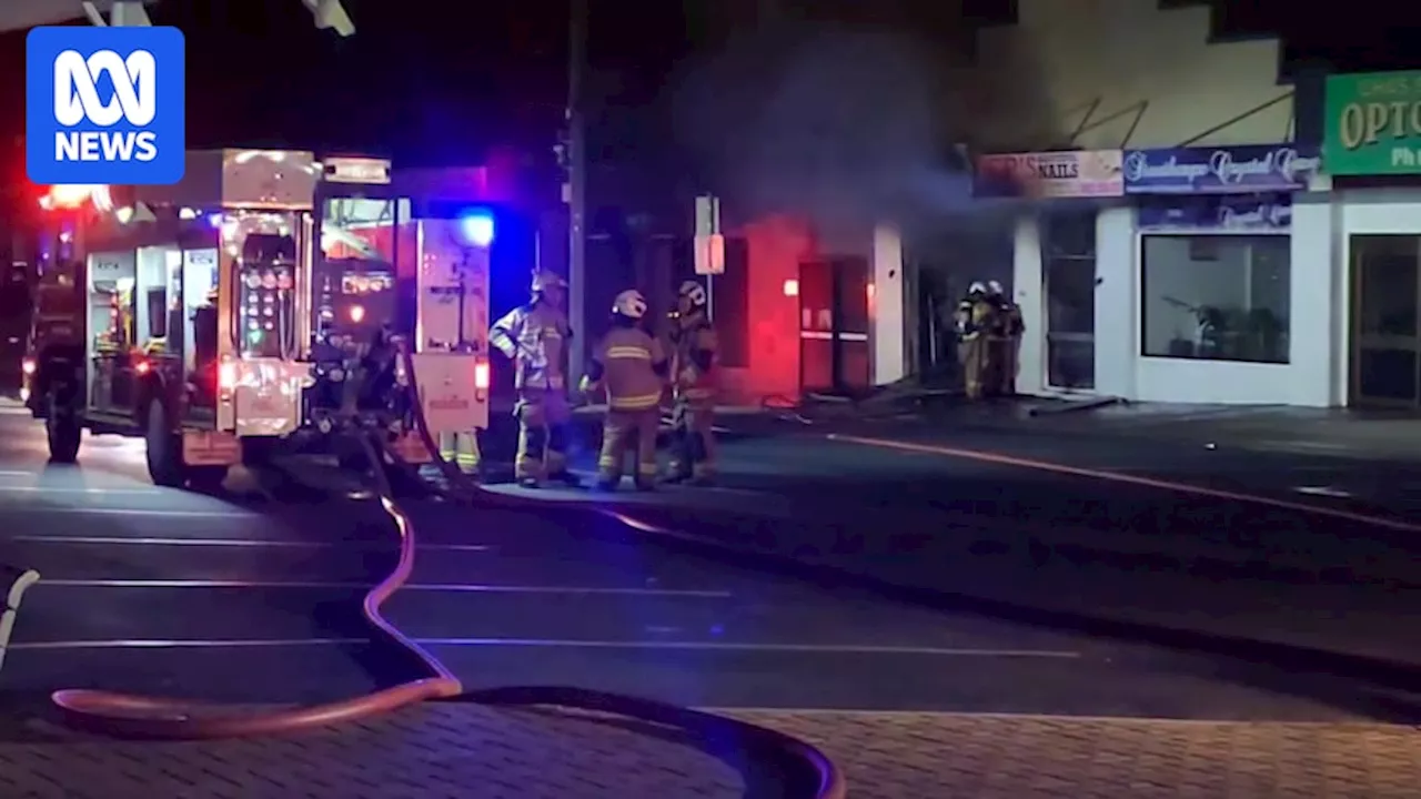 Tobacco Shop Fire in Queensland, QueenslandA newly-opened tobacco shop in Stanthorpe, Queensland, has been heavily damaged by two suspicious fires in less than 48 hours. The most recent blaze occurred around 2:30am on Tuesday, spreading to nearby businesses.
Read more »
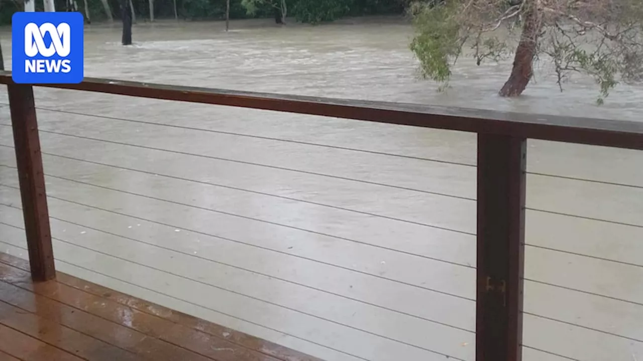 Queensland floods live: Crocodile warnings as North Queensland gets months of rain in three daysFloodwaters are rising for the third day across parts of north Queensland, with some pockets receiving more than a metre of rain since Saturday. Follow live.
Read more »
 Stormy, hot weather forecast for most of Australia with flash flooding risk in NSW and QueenslandBoM says expected storms in Brisbane and severe thunderstorms and heavy rain in Sydney due to lingering north-easterly winds
Read more »