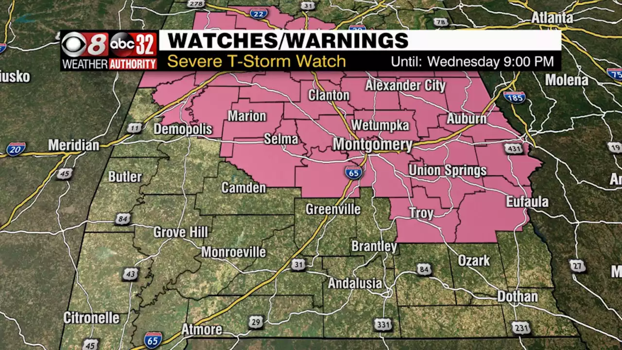
A severe thunderstorm watch continues until 9PM for central Alabama. Damaging wind gusts up to 70 mph, hail 1' size or larger, and a couple tornadoes possible.
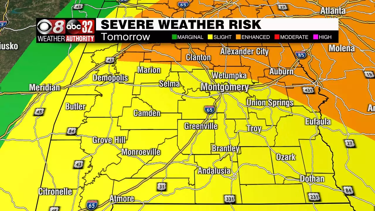
A severe thunderstorm watch continues until 9PM Wednesday evening. Intensifying storms during the afternoon and evening could produce straight-line winds up to 70 mph, hail 1″ size or larger, and a tornado or two. We may experience more than one round of storms. A narrow line of showers/storms was moving northwest to southeast through west Alabama between 1:30 and 2PM. That gradually moves east/southeast with time.
Additional clusters of storms could develop in advance of this in east or southeast Alabama. They could become severe too. Additionally, another line of storms may move northwest to southeast through our area this evening along a cold front. Those storms could be severe. However, that should be the last hurrah, with the severe risk winding down by midnight. The sky gradually clears tonight with rain tapering off as the cold front moves to our southeast.
The rest of the week looks quieter, cooler, and breezy to windy. Thursday morning lows fall into the 50s, but afternoon temperatures only recover into the 60s to low/mid 70s despite a mostly sunny sky. Thursday night lows fall into the 40s. Friday could be quite windy, and cool with highs in the 60s. However, Friday features some sunshine and no rain. Friday night looks rather cold for this time of year. Lows fall into the low 40s, maybe 30s for some by sunrise Saturday.
Saturday remains cool and breezy with sunshine and some clouds. Afternoon temperatures likely remain shy of 70°. Saturday night looks cold again, with lows in the upper 30s to low 40s. Sunday looks warmer and mostly sunny with highs in the mid 70s. Sunday night looks less cold with lows near 50°. Temperatures trend warmer next week with a gradually increasing rain chance each day. Monday features just isolated showers here or there. But Tuesday’s rain could be a bit more widely scattered, with a mostly cloudy sky otherwise. Some storms could be in the mix next Wednesday. By that time, models hint that another storm system approaches Alabama. However, certainty in the timing/evolution of next week’s potential system is low at the moment.
Australia Latest News, Australia Headlines
Similar News:You can also read news stories similar to this one that we have collected from other news sources.
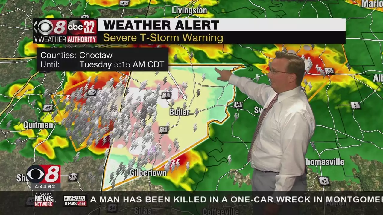 Strong to Severe Storms Roll Through Alabama Today - Alabama NewsThis morning, the organized area of rain and storms will move through the state, generally in the 6AM-3PM time frame. Stronger storms will be capable of producing damaging winds, hail, and some tornadoes are possible. The rain will be heavy at times statewide morning with rainfall totals of 1-3 inches possible.
Read more »
 Tuesday Severe Risk Ending, Another Risk Wednesday - Alabama NewsTuesday's severe risk winding down, but another looming Wednesday.
Read more »
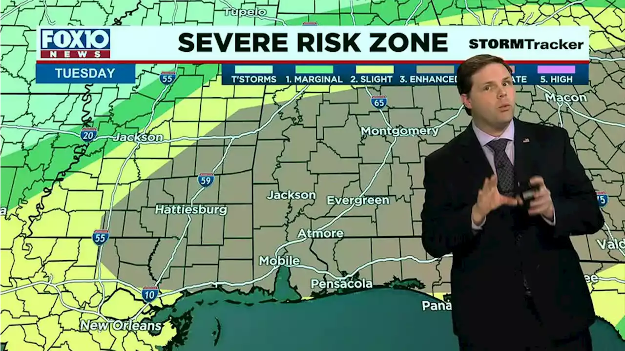 All modes of severe weather possible todayWe’ve got a very humid airmass this morning and another risk of strong to severe storms will roll in during the first part of the day and exit during the afternoon.
Read more »
 Wiregrass braces for another round of storms Tuesday through WednesdayThe Wiregrass braced for round three of severe weather Tuesday with another chance of storms Wednesday into Thursday.
Read more »
 Higher humidity, temps, rain/storm chancesAction News Jax Chief Meteorologist Mike Buresh says we’ll climb into the mid-80s this afternoon with a threat for rain and storms.
Read more »